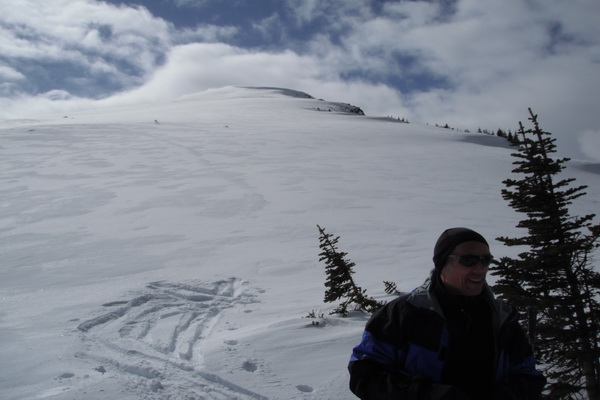
Jim and I up today into Watchtower Basin near Medicine Lake south
east of Jasper. Skied up summer trail to upper creek in 2 hours.
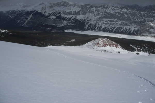
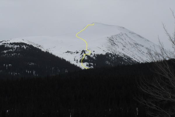
Always looked at this nice NE low angle ramp that leads up to a
2600ft summit on the true left side of the Basin. This peak forms the
left side of Watchtower Basin. Upper slopes were low angle up to 25
degrees and led down through a nice open bowl and boulder field and
back to the creek. Most of the terrain is less than 20 degrees.
In general at treeline the snowpack is about 120-130cm....just enough
to keep you floating!
Upper run is close to 700 metres and most of it was good skiing,
until you get back down close to the creek. Some of the westerly or
southerly slopes were sun crusted with sugary snow underneath. The
summer trail had an old track in it which was better than we thought
for coming down. Survival skiing for the last 200 metres of elevation.
We noted some localized whoomphs in some of the flatter shallower
areas in the upper bowl.
Some of the S-SW aspects across from the parking area at Watchtower
have released as well as some activity on the Medicine Lake Slabs.
Felt like winter up high....spring down in the trees.
This is a great trip, over 1000 metres elevation gain from the road
and about 8 kms one way.
Probably best done a bit earlier in the season, and pick a good snow
year! Certainly an aesthetic line and maybe a possible new classic in
the Jasper area?
Peter Amann
Mountain Guiding
Box 1495, Jasper AB, T0E 1E0
780 852 3237
cell 780 931 2521
www.incentre.net/pamann/
pamann@xxxxxxxxxxxx
amannpeterr@xxxxxxxxx
 upper Basin.jpg
Description: JPEG image
watchtower left summit2.jpg
Description: JPEG image
watchtower left summit.jpg
Description: JPEG image
_______________________________________________
These observations and opinions are those of the person who submitted them. The
ACMG and its members take no responsibility for errors, omissions, or lapses in
continuity. Conditions differ greatly over time and space due to the variable
nature of mountain weather and terrain. Application of this information
provides no guarantee of increased safety. Do not use the Mountain Conditions
Report as the sole factor in planning trips or making decisions in the field.
Please check out http://acmg.ca/mcr for more information.
| 