|
Just out from a mini Wapta
Traverse (Bow to Peyto) for the UofC with fellow ACMG member Phil
Wilhelm.
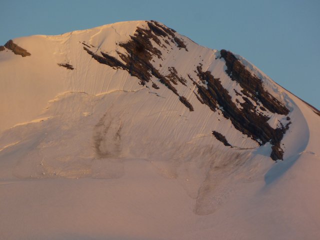
We had quite the tempest
that rolled in on the night of the 20th with lashing winds and heavy rain that
continued all night. Not sure if that may have caused these
cornice triggered avalanches that went quite large on Mt.
Baker:
 On the 21st we had
excellent travel conditions on very well consolidated snow with no visible
weaknesses. On the 22nd after a solid overnight freeze with clear skies we
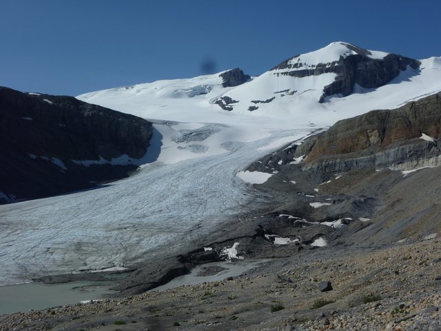
donned crampons to descend the Peyto glacier. Widespread sun cups on the
snow surface made for attentive walking.
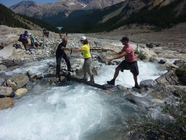
 Cauldron creek was raging
pretty good by noon. No way I would want to cross that by walking on the
stream bed. Fellow guide Fridjon Thorleifsson did a great job building a
log bridge that we cairned on both sides.
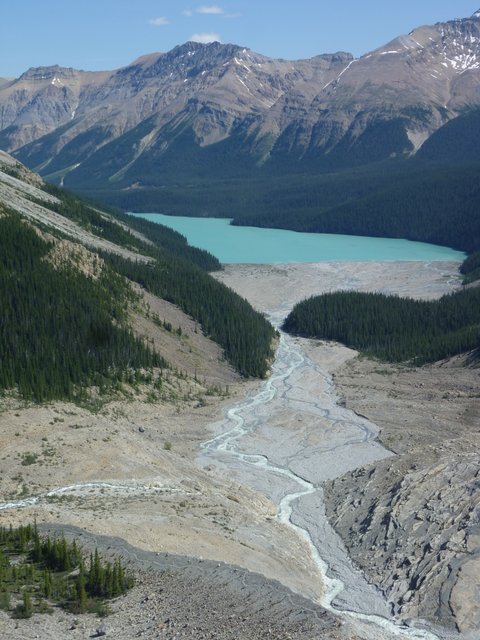
 I'm guessing the water
levels have increased since Geoff Ruttan's July 5 post as we were forced to
side hill well past the treed constriction in the photo below before we could
drop down to the gravel flats. There are now good deep steps cut into the
bank for the northern half of the traverse (we traveled in the forest for the
first half but were forced back down towards the river by deadfall half way
across). The short rock climbing step is no longer required (or possible
at these water levels I believe).
 We crossed multiple braids
in the river delta with hut sandals to reach the trail on the east side.
We made the mistake of exiting the gravel flats at the first large slide path
but this requires a 150m bush whack through tight nasty alders to regain the
trail so we waded back out to the gravel flats and finally exited at
the slide path that empties right into Peyto Lake (the one that the trail
switchbacks inside of). If you were hiking in to the hut I would recommend
crossing here as well since these lower braids have to be crossed at some point
anyway.
Water levels have made for
a lot of messing around on this route now - start early to give yourself lots of
time to deal with constantly changing conditions.
The mosquitoes were fairly
aggressive in the forest starting and finishing the
traverse.
Cheers,
Shaun King ACMG Mountain
Guide
_______________________________________________ These observations and opinions are those of the person who submitted them. The ACMG and its members take no responsibility for errors, omissions, or lapses in continuity. Conditions differ greatly over time and space due to the variable nature of mountain weather and terrain. Application of this information provides no guarantee of increased safety. Do not use the Mountain Conditions Report as the sole factor in planning trips or making decisions in the field. See http://acmg.ca/mcr for more information. See http://informalex.org/subscribe.shtml/unsubscribe to remove your name from this list. |
| Previous by Date: | [MCR] Glacier National Park Trail Closures- Beaver and Copperstain, Public Mountain Conditions Report |
|---|---|
| Next by Date: | [MCR] Bugaboos, Public Mountain Conditions Report |