My good friend Brian and I went to look at the Upper Terrace creek
area to check this area out and look at Mt Saskatchewan via the SW
ridge. Aug 8th we bushwhacked our way from the big bend south of the
Columbia Icefields up the right side of the creek that drains the
north glacier of Mt Saskatchewan. This is quite tedious in places to
say the least. Once reaching treeline we contoured up and right
through the moraines the reach the upper cirque heading north of the
towers, north of the main peak of Mt Sask.
Though a route is described through a col south of these towers the
map showed gentler terrain through the north pass. One traverse on
steep scree under a snow face was needed to gain this col.
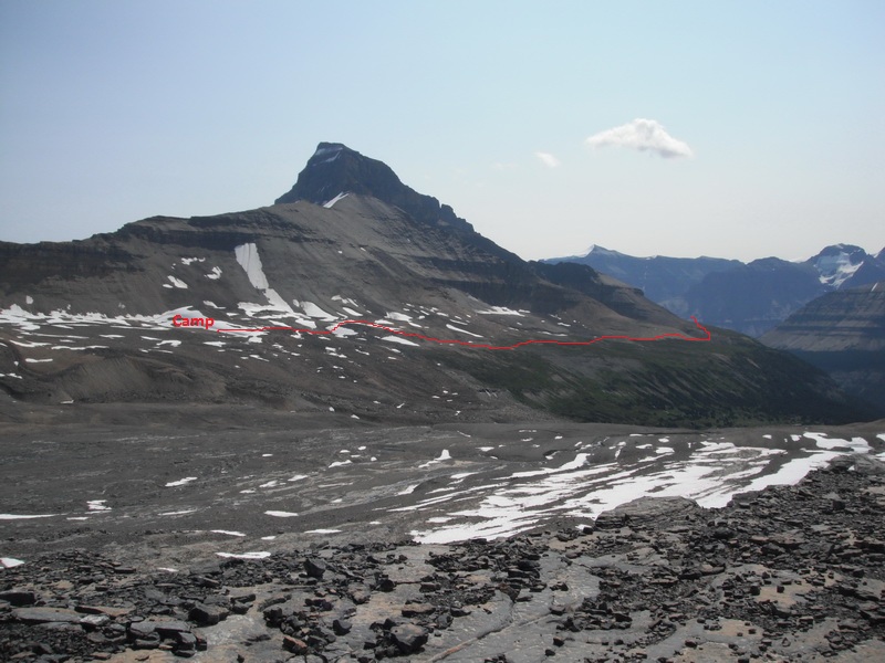
From the col we headed through a pass which put us in the head of
Terrace creek under the North towers of Mt Sask. This took over 9
long hours to a camp at 2300 metres.
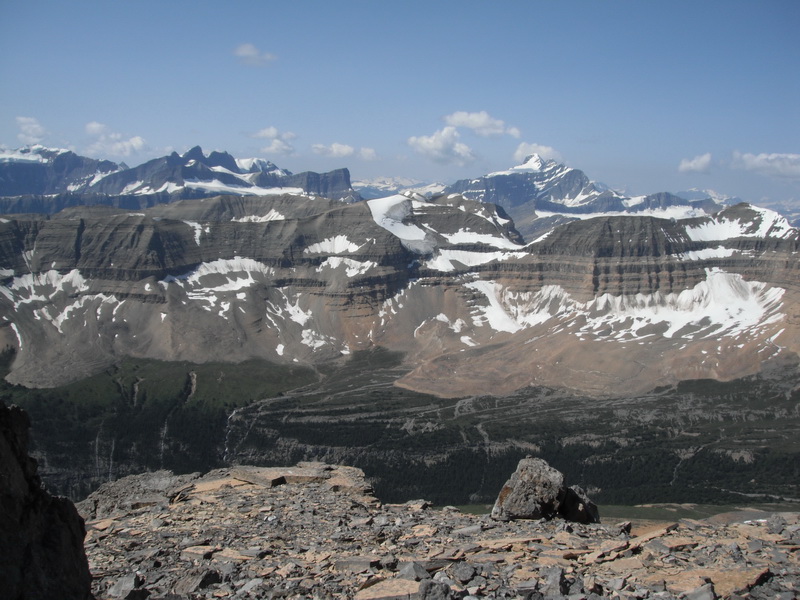
The second day we headed to the pass heading to Castleguard meadows
and up a small rounded summit of 2600 metres with spectacular views
of the icefields area.
From descriptions of the ascent route on the SW side of Mt
Saskatchewan we planned on going to have a look and see. We brought a
30 metres rope and our usual glacier travel gear.
A 2.5 km traverse around the peak was done in spectacular meadows to
gain the East side of the SW ridge. Very tedious scree led to the
first rock band. We scanned this cliff for a while and figured the
first break just right of the ridge was the way. We climbed 2 short
pitches of easy but very loose fifth class to the second ledge. We
looked around for the second break but must not have traversed far
enough as everything we looked at was steep, definitely 5th class and
wet in many places. It did not make sense to lead up with a short
rope and a few slings hoping for the best. We enjoyed the scenery,
filled water bottles from some of the many drips and slowly made our way back.
The following day we retraced our route to the col, climbed a peak
just to the north and then descended into the basin again and down the creek.
For the climb of Mt Saskatchewan I would think about a longer rope,
even a 50m twin rope, and maybe a few pins if you get off route. We
found a few horns on the first section that were useable.
Many Kudo's to the hard cores like Rick Collier who climb up and
down this chossy rock without a rope!
A camp a bit closer might have been a good idea, but you have to
carry it all back up and out again.
It was also good way to scope out the Pat Sheehan circuit which uses
this area to make a ski loop into Castleguard meadows.
An important last note is that the map to this area is all 40 metre
contours....there is a lot of features that just do not show up....
Peter Amann
Mountain Guide


Peter Amann
Mountain Guiding
www.incentre.net/pamann/
pamann@xxxxxxxxxxxx
 terrace ck and mt Bryce.jpg
Description: JPEG image
Camp and Mt sask.jpg
Description: JPEG image
_______________________________________________
These observations and opinions are those of the person who submitted them. The
ACMG and its members take no responsibility for errors, omissions, or lapses in
continuity. Conditions differ greatly over time and space due to the variable
nature of mountain weather and terrain. Application of this information
provides no guarantee of increased safety. Do not use the Mountain Conditions
Report as the sole factor in planning trips or making decisions in the field.
See http://acmg.ca/mcr for more information.
See http://informalex.org/subscribe.shtml/unsubscribe to remove your name from
this list.
|