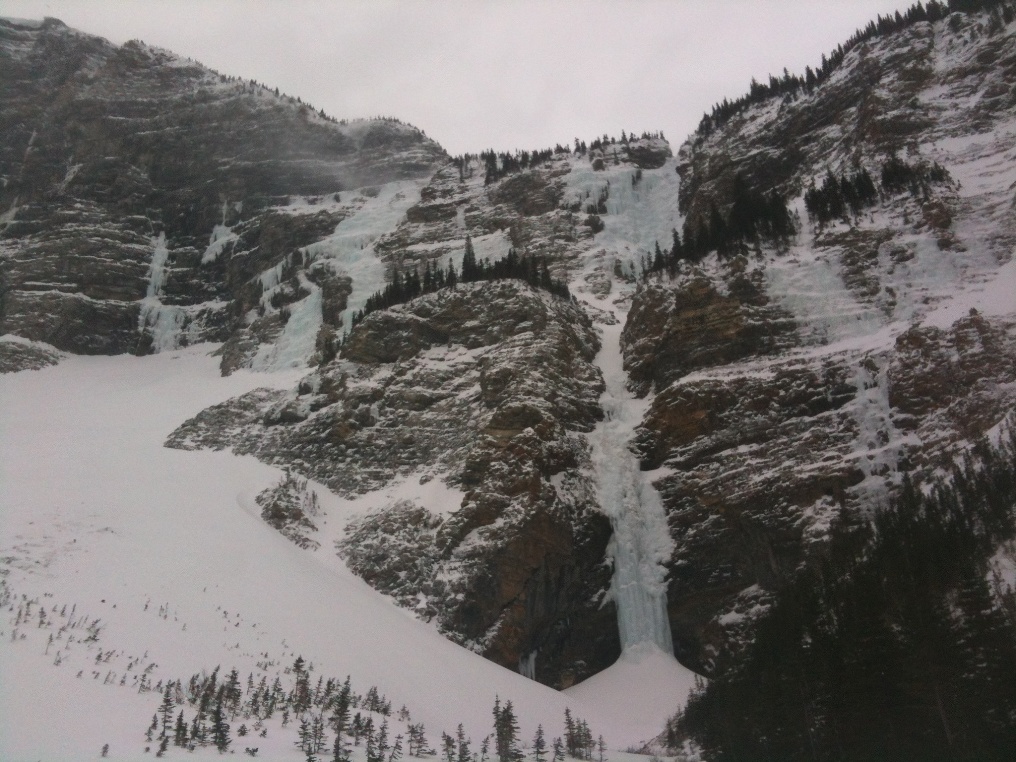
Visited Sullivan Falls with Steve Holeczi and JP Kors last Thursday.
Approach:
With a four wheel drive truck and good clearance we were able to access the Marquis Hole Picnic Area. The Waterton River was open so we crossed the Middle Waterton Lake on solid ice. From here we chose open meadows that brought us to the Wishbone trail which we followed to the Vimy Junction. We stayed left at the junction and snowshoes were useful on the climb to the top of this ridge. We continued South along the trail here for a bit (150m?) before dropping to Sofa Creek in a down-trending SE traverse from the second open area. This was off trail and through a stand of Douglas Fir. There was a significant amount of blow-down and snow shoes were essential whereas skis would not have helped.
Sofa creek was flowing but easy to cross and we traversed the West and South-western aspects of Sofa Mountain well above Sofa Creek. The route here crosses several slide paths however at this time these were largely stripped of snow.
The final few meters to the base of the route cross under a large avalanche fan as you walk up a definite terrain trap. We found a soft slab starting to form here.
It took us 3.5 hrs to the base having scouted the route previously.
The Route:
The first pitch provided a nice groove for 20m on grade four ice and finished at a small overhang at about 50m. The pillar is freestanding and is cracked as in the photo in the guidebook however there was little question to the stability of this large well supported column. We climbed as second short pitch to the next ledge above this and belayed on a blob of ice to the right. From here a small section of ice led to a steep snow-filled gully. Careful assessment of the slab was needed here before proceeding. 60m lead right and around the corner to a solid tree for a belay.
We stayed right from here in the trees and traversed in to the final pitches. There were again concerns for the stability of the snow slopes. The final ice pitches are about 80m - 90m long and grade 2-3. There were daggers over the left side and a cornice hanging over the central groove. We backed off of the top right side about 5m from the top finding the ice to be a thin shell that felt likely to collapse.
The Descent:
We left two Abalakovs on the upper tiers and chose not to walk down climber's left from the midway ledges due to avalanche concerns. Instead we retraced our steps in the trees to the climber's right and slung a tree. We were able to rap 60m here. Another Abalakov and about 45m to the ground.
It took us 2.5 hours to walk out and our 4:30 am start put us to the car at 17:00. Overall choose your conditions carefully before heading in here but it is a beautiful place with a lot of ice on the surrounding walls. Conditions do change quickly given the amount of wind the area experiences and may be very different than areas closer to the divide where most of the skiing in the Waterton area occurs. If you found the avalanche conditions to be too much on the North aspects you may at least find a consolation prize on some smaller grade 3 routes on the SW side of the valley.
There are several sheltered places to camp however the creek appears dry immediately below the route. Random camping, such as would be the case here, is with approval from Parks Canada only. You would need to visit the Warden Office in the Parks Compound during business hours to obtain a permit.
Tim Haggarty
IFMGA
Visitor Safety Technician Waterton Lakes National Park
403 859 5138

via
Peter Tucker
Executive Director
B: +1.403.949.3587
M: +1.403.689.4324
ed@xxxxxxx | www.acmg.ca


