Hi MCR Subscribers,

On Tuesday I skied with friends during the storm in the vicinity of Black
Prince. We skied easterly slopes treeline and below. We observed 10-20cms of
new storm snow. On aspects below 30 degrees, the storm snow was well bonded. On
aspects greater than 30 degrees, we saw cracking and one propagation 50m into
40 degree terrain. This was below treeline in a 10cm slab.

Today we skied north and south aspects in the vicinity of Highwood Pass at
treeline and below. Below treeline the snowpack averaged 70cm. At treeline, it
was between 10-40cm. The storm snow appeared well bonded to the midpack
although two independent compression tests produced moderate resistant planar
results 40cm down. We also observed sluffing of the top 10cm of storm snow in
steeper terrain. There was plenty of evidence of wind transport particularly on
the scoured easterly aspects. Temperatures hovered around -10C throughout the
day.

Brent Peters
Alpine Guide
Apprentice Ski Guide
PeakStratagem.com

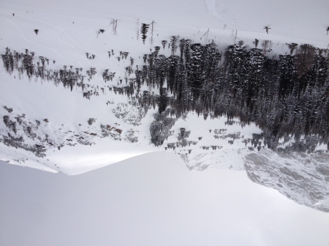
Looking back up towards Pocaterra. We skied terrain in the trees on the left.
Above treeline there is less than 10cm of snow.

Sent from my iPhone
_______________________________________________
These observations and opinions are those of the person who submitted them. The
ACMG and its members take no responsibility for errors, omissions, or lapses in
continuity. Conditions differ greatly over time and space due to the variable
nature of mountain weather and terrain. Application of this information
provides no guarantee of increased safety. Do not use the Mountain Conditions
Report as the sole factor in planning trips or making decisions in the field.
See http://acmg.ca/mcr for more information.
See http://informalex.org/subscribe.shtml#unsubscribe to remove your name from
this list.
| 